Snow in Brooklyn. On April 2.

When I woke up on April 2, Kathy was staring out the window of our hotel room. “What are you looking at?” I asked. “Snow,” she replied. “I don’t think I’ve seen snow this close since 1969.”

Well she has lived a long time in California. It was now clear what the clouds we flew over on the Great Plains had. Snow….lots and lots and lots of snow. Well, compared to Wisconsin, where I used to live, it wasn’t much, but it was pretty impressive for the east coastd on a morning in early April. What ever happened to March coming in like a lion and going out like a lamb?

I got up and looked out at the snow. I then realized why it will be a while until Smartphones truly replace the SLR camera: you never know where that “Smart” phone will chose to focus. Here, it focused on the snow that had hit the window and melted instead of on the street below:

For those who have never seen snow falling, it’s quite a sight:

Here’s another view:

We had breakfast, waited until the snow stopped (Wisconsinites know how to behave in snow; Eastern Coast people, not so much), and set out to meet Daniel and Molly for lunch.

Brooklyn, April of 2018….some personal comments and pictures

As the three (3) readers of this blog have long-ago determined, a teacher can’t write a blog during the school year. It’s not that there aren’t lots of things to write about. It’s just that it’s really, really hard to write and illustrate a blog like this (illustrated with examples and pictures) while at the same time teaching, preparing lessons, counseling students, grading homework, grading other assignments and tests, going to meetings, talking and emailing with parents and students worried about their grades (My standard response:  “try to put in some effort and study time!” ).

Between April 1 and April 5, my wife Kathy and I flew back to New York City (note to residents of Frisco: the only “City” with a capital “C” in English is either the financial district of London or New York City, not San Francisco…admittedly a charming provincial town with excellent atmosphere and food, but a “city”??????  Get real……) to visit our son Daniel in Brooklyn and his girlfriend Molly, an actress currently appearing on Broadway in the ensemble for the musical “Waitress.” Although I usually spend my time on this blog discussing teaching, science, or students, I hope my three readers will forgive me for spending a few posts about our time in New York (well, Brooklyn, mostly) with Daniel and Molly.

By way of introduction, many friends and family members had already met Molly. All reported that she was charming and lovely and….hey, why haven’t the two of you gone back to meet her? Between their entreaties and Daniel’s suggestion, we finally decided to go east during our second week of spring break. So on Easter Sunday (April 1, 2018), we flew out at 7:30 am PDST to JFK on Long Island, though it’s still a part of the City of New York. There was the additional benefit that Kathy’s wonderful cousin Kate, and her equally wonderful husband Bill, also have lived in Brooklyn for 30+ years, and this gave us an opportunity to be with them as well.

We arrived at LAX just after 5 am, figuring that getting through security would be no problem. Wrong! Took about half an hour. I’ve been flying every summer for a while, but Kathy hasn’t been on planes for a while and was shocked by the lines and delays. But we eventually made it through, and caught good tail winds to New York, arriving almost an hour ahead of schedule.

Nothing much memorable happen on the trip east. One thing I’ve noticed in the past couple of years is that most passengers pull the window shade down because they want to read their electronic devices. A couple of years ago I felt like I was inside a flying coffin because it was so dark. This time I had a window seat, so by God that shade stayed up as I watched the scenery fly by. By the time we’d reached the Great Plains, however, everything on the ground was obscured by a thick layer of clouds. Uh oh, I thought: prevailing winds will carry whatever is under the clouds eastward and should arrive in New York by the next day. Stay tuned for video.

The only memorable picture I have is just before we landed at JFK, which is in the southern part of Brooklyn. We flew about 20 miles past JFK to the southeast,  well out into the Atlantic. When we turned back there were fully a dozen major cargo ships bunched up like an insect swarm. This our first glance:

Then they spread out:

Here’s more:


Though I couldn’t get a good picture of it, the approach to JFK is built on wetlands. Boy, and howdy. Furthermore, people have built along the barrier islands to the south, a disaster just waiting to happen. Mother Nature is quite thorough about eroding barrier islands and moving the shoreline inland; all the money in all of America can’t prevent that. Here’s a picture of what’s happening:

Kathy and I had both stayed in Manhattan when we were younger, so there was no reason to stay there when we really didn’t know Brooklyn. I was in Brooklyn when I was 4 and my parents were traveling around doing historical research. The only thing I remember is that my mother always told the story that the lawn in front of the townhouse was so small that the husband cut the grass with a pair of scissors.

We stayed in the northwestern part of Brooklyn near “downtown Brooklyn.” It’s not an oxymoron like “beautiful downtown Burbank.” It’s an exciting urban community, yet less imposing than Manhattan. Everyone walks everywhere, which is great fun. Great views, too, but that’s for later.

We stayed at the EVEN Hotel which proved to be convenient to just about everything we were interested in. It’s a chain of “health” hotels where all the room numbers are even. Nothing odd anywhere in them, except perhaps the name. Here’s a typical view of their room. Ours had more of a bar stool than a chair, but was otherwise familiar, even including the ball in the picture which we gathered was supposed to double as a chair. (Daniel was the only one of us who ever sat on it.)

Because Molly was at work on Sunday nights (the show goes on) and Daniel was at a concern, Kathy and I were on our own. We poked around the area, discovering Atlantic Boulevard, the main thoroughfare through northwestern Brooklyn, which is definitely not high-rise:

Atlantic has lots of interesting little shops. When I was getting oriented, we even had locals come up and ask us if we needed assistance. Maybe we look older than we are. In any event, Brooklyn was the antithesis of the “cold New Yorker”:

Daniel had suggested a Middle-Eastern restaurant called the Bedouin Tent, which we found without difficulty:

Although they had take-out, we ate in the back. There’s a place out back that looks lovely for summertime, which April 1 was, alas, definitely not. The food was excellent, and it’s well worth a visit if you’re in the area.

It had been a long day, so we went back to the EVEN and went to bed, wondering about what weather the morrow would bring. It turned out to be memorable.


Good eats in Ventura

We were pleasantly surprised to find a number of excellent restaurants in Ventura. In fact, the food was good enough that we never had to dig into our picnic basket full of goodies, and only ended up eating two meals a day.

The picture above is of twilight….end of nautical twilight, I’d say, with the waxing crescent moon, taken on our way to dinner on the first night there. The island is Santa Cruz Island….about as long as the island of Manhattan.

SPENCER MACKENZIE’S:

Our first restaurant was  Spencer Mackenzie’s Fish Tacos. It’s named after the owners’ son and daughter. It’s a bit too nice to be a real dive. Great, friendly atmosphere. You can eat outside if the weather suits you (a bit too cold for us, that night). There’s a counter you can eat at if you don’t want to sit outside or wait for a table inside. Also take-out. We both had clam chowder, which was clearly not out of a can, and one of the best soups I’ve had in a long time. Not a lot of cream, and not oversalted. Be forewarned: their portions are big. The seafood was excellent and we were both quite full. Lots of visiting fireman around. The younger kids who came in with their parents were wide-eyed to see the fireman. We heard that the restaurants in Ventura served the firemen for free during the fire.

PETE’S BREAKFAST HOUSE:

The next morning we went to Pete’s Breakfast House, just to the west of Ventura High School. Glad that school wasn’t in session or we’d never have gotten in.

Pete’s may not look like much from the street, but it’s welcoming and delightful within. All sorts of nautical stuff, and a mural on the second room inside:

Standard American diner cuisine, well prepared and great service. If there’s a line, it moves quickly. Also has a counter if you’re alone.

AUSTEN’S RESTAURANT:

A bit upscale for the evening, Pierpont Inn had Austen’s Restaurant, named after the founder’s son. It’s on the site of and run by the Pierpont Inn, and apparently had a commanding view of the ocean from the second floor of the original building. Because the building had been red-tagged for restorations undertaken without a building permit, we couldn’t visit the original restaurant. It has since moved to the Camulas room (presumably named after Rancho Camulas). Food is still good, and we sat by a fireplace which the staff fired up….a good idea, since it was cold! Still worth eating at, even if (temporarily, we hope). Service was thorough but unobstructive.

CAFE NOUVEAU:

On the morning we left, we had breafast (or brunch….hard to tell, it was so late at the Cafe Nouveau, also not far from the Pierpont Inn. It’s a different restaurant, housed in a small Spanish revival bungalow, with lush plantings outside and a large outdoor patio. The decor is eclectic (50’s-style Formica tables with chrome trim in Spanish-style rooms with hard floors. It sounds a bit odd, but it works very successfully. Service was friendly and very attentive.

In reading the reviews, most people raved about the beignets, so we tried some. Good, though I don’t think beignets are my favorite kind of doughnut. Kathy had Eggs Florentine, and I had Eggs Nouveau, which was an interesting cross between Eggs Florentine and Eggs Benedict, with a tomato replacing the ham. Superb Hollandaise sauce, and the spinach was perfectly prepared. We left town and didn’t eat for the rest of the day!

So we had very good food in Ventura and enjoyed each place.  When we got back, one of my students told me that he’d had the greatest fish tacos ever in Ventura….at Spencer Mackenzie’s. One of my wife’s colleagues knew we were in Ventura, and when Kathy reported on having beignets with maple syrup and bacon, she said “let me guess…..Cafe Nouveau? We always go there!” So don’t think that Ventura, despite being a small city, is not without its culinary delights, or that those delights aren’t recognized and remembers, even from people who live in the Big Bad City.

Pierpont Inn in Ventura

We discovered the century-old Pierpont Inn as we were looking around for where to stay. Originally a Craftsman-style hotel built in 1910, the Pierpont sits on a bluff overlooking the Pacific Ocean . Yes, it’s sandwiched between the train track on its north and Highway 101 (constructed in the 1950’s) to its south of and below the bluff on which it sits,  but the views from the hotel grounds remain spectacular, and we found it a pleasant place to stay.

Sumner P. Hunt, a well-known Los Angeles architect who among other things, supervised the construction of the 1889 Richardson Romanesque City Hall, and designed the Doheny Mansion (now part of the Mt. St. Mary’s campus near U.S.C.):

He also designed  the Glen Tavern Inn in Santa Paula, where coincidentally we stayed on an early trip to Ventura County:

The Pierpont Inn looked like this shortly after construction:


The Pierpont  has been added onto over the years, and its two main wings are post-World War II additions that are comfortable but not out of the ordinary. However, there are enough quirky little buildings around to make the grounds very picturesque. The landscaping is dense and lush.

In there rose garden, there’s a grotto-like gazebo (sounds strange, but take a look at it), which seems to be popular for weddings:

Nearby are the Rose Cottages:

Not mud-and-wattle, but still romantic. The Wayside Room is a California ranch addition that faces directly onto the Pacific:

And a gazebo, also popular for weddings, is on the lawn outside the Wayside Room:

Here are some views from the gazebo after sunset. First, looking southeast (left), we see the three Anacapa Islands: east, middle, and west (the tallest). You can land only on East Anacapa.

Moving west, here’s West Anacapa and the easternmost point of Santa Cruz Island. Santa Cruz is some 20 miles long, whereas the Anacapas are narrow and less than a mile in length.

Finally, a look at the eastern end of Santa Cruz Island. BTW, all three of these photos show Highway 101, which is raised as at goes by the Pierpont.

The hotel was something of a Hollywood hideaway during the 1930’s, when Ventura apparently was a difficult place to get to from Los Angeles. In this photograph from 1941, you get a sense of how removed it was from the big city. This was also before Interstate 101 was built along the base of the bluffs, and the various post-war additions built.

Erle Stanley Gardner, author of the Perry Mason novellas, lived in Ventura for about 20 years between 1917 and 1937, where he practiced law. His his first Perry Mason novel, “The Case of the Velvet Claws,” was set at the Pierpont Inn. We may actually have to read it, although I recall that Gardner was a pretty atrocious stylist in his writing.

The Pierpont Inn was recently sold, and is being managed by Wyndam Gardens. There’s been some disagreement with the city of Ventura for the past couple of years, which red-tagged the original building after the owners started making restorations without getting any building permits. Oops! The first floor has been remodeled so many times that there’s not much original there, but the second floor, which housed Austen’s Restaurant, is apparently vintage. Since the building was red-tagged, we couldn’t explore it, but hope that the new owners can get busy on the restorations soon and reopen the original Craftsman building.

The last (pretty much) about the Thomas Fire

We actually did some interesting things in Ventura apart from the fire, which I’ll get to shortly. Meanwhile, I did come across a couple of stunning pictures of the fire, from opposite viewpoints.

The lead-in photograph is a satellite picture of the fires that broke out on December 4. The Thomas Fire is the top one. It gives a great sense of the size of the fire and force of the winds.

The second one is not from space, but from the ground looking up. Looks to me like it was taken at dawn on the first full day of the fire (December 5):

The islands off the coast look like West Anacapa and Santa Cruz Islands. The lights are, I think, from offshore oil platforms. Scary stuff.

The Thomas Fire in the city of San Buenaventura

When we got to Ventura about noon on December 19, we could still smell the smoke in the air. It got hazier and hazier as we descended the Santa Clara Valley to the Pacific Coast. It didn’t look as bad as the picture above, but the odor was definite and the haze apparent.

We had been through Ventura and driven around many of its neighborhoods the year before. One of the nice things about Ventura is that it doesn’t do wholesale destruction of its buildings. Many of the original commercial buildings are still in use, and the neighborhoods haven’t been blighted by McMansions. Even along commercial routes, you’re as likely to find remodeled Spanish bungalows serving as shops instead of having them torn down for strip malls.

Anyway, we hadn’t been into the West end of town. I’m repeating the picture I posted at the beginning of this series to give you some orientation. The west end is the part on the left of the picture that thrusts up toward the top of the picture. For those of you who like to go to Ojai, that’s State Route 33 that follows along the Ventura River. To the left of where things get narrow by the coast is the downtown area, squeezed in between the mountains and the Pacific, and the city spreads out along the hillsides, which are outside the city limits. The hills are where the fire came through.

It’s hard to see the burn areas within Ventura unless you’re on top of it or far away. If you’re in the middle-distance, the hills actually get blocked by the buildings. But then you come onto an area, and you can see the destruction.

Our first exposure was on the west end (right of the picture), which we hadn’t seen before and I wanted to visit. Though it’s not too clear in the pictures, there fire had burned everything off the hillside:

One of the hillsides further to the north was completely bare:

We came back through the center of town, and I realized that I’d always wanted to visit the old courthouse, which has been converted into the Ventura City Hall. However, I’ll come back to that in the next post. But we went inside and saw huge, industrial-strength air purifiers every few feet, roaring loudly as they continued to clear the smoke and odor more than a week after the fire had moved west.

After our visit to the old courthouse, it was lunchtime. We had a brought a picnic along, and so I looked for a park. I’d heard of Arroyo Verde Park, to the east along the mountains. It’s a beautiful expanse of green at the foot of one of the arroyos leading out of the hills:

If you climb up into the hills, you get a fabulous view of the Pacific Ocean with Arroyo Verde Park in the foreground (the island you see on the upper right is Santa Cruz Island):

But the magic words are “climb” and “hills,” and the hill are covered with chaparral, as seen in this aerial shot:

Indeed, if I’d been searching YouTube, I should have expected that the park might well not be open, even a week after the fire had come through:

The video is worth watching because you can both see and hear the Santa Ana winds. If you haven’t experienced them, it’s hard to understand how fires can spread so quickly. Once you’ve been in one, the understanding is embedded deep into your subconscious.

Foothill Drive is a beautiful highway running along the north side of Ventura and, as its name suggests, it’s in the foothills. We started seeing real fire damage as soon as we approached the park. In many stretch of Foothill Drive, there is nothing but mountainside to the north. Here, the fire burned straight down to the road:

When we got to the park, it was completely closed. We drove to the east, and saw lots more burn damage:It was hard to tell if that was a pad where a hillside home had once stood. Where we turned around a house abutting Foothill Drive and burned completely but, in a weird combination we continued to see elswhere in town, one house can burn to the ground while its neighbors are practically unaffected. Here’s a picture I took of such a burn site, except that I snapped it a second too soon to show the damage:However, in looking through the already published pictures, I got another view of the site, which was typical:  house and cars burned:


A home and car burned by theThomas fire are seen Tuesday, Dec. 5, 2017, in Ventura County. (Photo by Andy Holzman/Special to the Los Angeles Daily News)

Here is the entrance to Arroyo Verde Park, closed to the public:

Note that the fire burned all the way down to the street, something you can see if you watch the YouTube video above.

We drove on a few blocks, then turned south toward the beach. Again, we passed areas where a single house had burned completely without a single wall or beam remaining, and the other houses appeared untouched. It seemed ghoulish to be taking picture of houses that might not have appeared in the media already, so for the rest of this post, I’m relying on already-published pictures in mainstream media to illustrate what we saw.

We didn’t see a lot of complete destruction, where nothing was left on a block, though there were some:

Instead, the destruction appeared to be highly localized, almost as though a house had been chosen at random and its neighbors spared:


Or this:

This picture also shows something we saw that’s just puzzling. The stand of trees on the hill at the left of the picture are eucalyptus, an extremely resinous Australian import that has long been popular in southern California. Firefighters refer to them as the “botanical match” because they catch fire so easily. The fire has clearly gone through this stand of eucalyptus, but they don’t seem to have burned. I suspect the firefighters on the scene hosed them down as quickly as they good, and that might have saved both the trees and other homes from the fire. (The caption on the picture identified that burned house as a small Craftsman style, meaning a lot of wood was used.)

This is one of the scarier pictures I’ve found, showing residents leaving in the middle of the night as the fire bore down on their houses:

And finally, one of the reports we heard at the places where we ate were that many palm trees had burned down. I wasn’t too surprised to hear that….the summer we moved to Riverside had a rash of palm tree fires set by restless teenagers in our area, and you could see them for miles away. The dead fronds at the top of the palms burns fast and hot enough to ignite the top:

I thought such fires were a thing of the past, but I guess palm trees are still susceptible, whether humans or Mother Nature delivers the spark.


.

Approaching the Thomas Fire through the Santa Clara River Valley

You might well think that these pictures here are of the Thomas Fire from December, 2017, at Ventura or Santa Paula. In fact, they’re from a September, 2009 fire called the Guiberson Fire that started farther up the Santa Clara River Valley at Fillmore. You could swap out any number of fires in the Ventura County chaparral over the years and find them almost identical to these or to those you saw of the Thomas Fire.

After we left Piru, we didn’t start seeing the expected fire damage until we got as far west as Santa Paula. Like many things in California, the damage caused by wildfires is often difficult to detect at a distance on the ground because there’s often haze in the air and because chaparral is never as green as people often expect, particularly after a dry summer. (Remember also that the seasons are inverted in California: the growing season is the winter when we typically get rain [though not this year, apparently], and summer is the dormant season since there’s no water besides irrigation.) Chaparral that hasn’t been dried out typically looks like the hills in back of Thomas Aquinas College in Santa Paula, where the Thomas fire started:

No doubts about why a fire could start and spread from here. Here’s an aerial shot of Wheeler Canyon, to the west of where the fire started and which later burned.


To my eye, the chaparral here is looks greener that usual, though that may be caused by grass that grows quickly in the winter but has shriveled up by later spring. Chaparral during most of the year typically appears to be a dusty, dark green or brown, which you can still see in both of the pictures. Thus, at distance a burned chaparral isn’t as obvious as, say, a burned forest in the Northwest where everything is quite green. Here was our first glimpse of the hillsides in Santa Paula as we bypassed the town on our way west to Ventura:

Another view, a few seconds later at 60 mph on Route 126:

Although it may be hard to see in these pictures, unburned chaparral may be dark and dusty, but it gives the hillsides a kind of bumpy texture if you’re seeing it from several miles off, as we were. What’s different about these pictures is that the mountainsides look quite smooth compared to, say, the background of the Thomas Aquinas College and Wheeler Canyon photographs posted above. By contrast, the current pictures show a mountainside with relatively little relief on it. Admittedly, it is difficult to see in the haze, even when taken through a polarizing filter as these were.

Many people, even residents of southern California, don’t have an appreciation of how fast a wildfire can burn….though after this fire season, anyone who doesn’t just hasn’t been paying attention. In preparing this post, I found the two maps below that illustrate the speed of the Thomas Fire. The first is at 11:30 pm on December 4.

To appreciate the power of the Santa Ana winds blowing at more than 30 mph, take a look at how far the Thomas Fire spread in just over 90 minutes:

As California’s population continues to grow, there will be more and more pressure to push into dangerous county in the hills to provide more housing, particularly lots of rich people like to live where there’s  a view. The risks, however, are substantial in most parts of California because fire is a natural part of the California environment, even without human sources. I’ll be writing more about the dangers of building housing in “undeveloped” areas during 2018, and will include issues of wildfire, fire protection/suppression, problems of flooding (we do, after all, get 100-year and 500-year floods), and the enormous but unseen financial costs of coastal development in areas where seaside rocks are eroding rapidly, undercutting multi-million-dollar structures with politically well-connected residents who are only too happy to pressure governments to spend vast amounts of money defending their surf-side castles that probably shouldn’t have been built on that location in the first place.

Lake Piru serves the super scoopers on the Thomas fire


As we’ve traveled around southern California in the past couple of years, the stress that the drought California has suffered since 2011 has become apparent. We see dead or dying trees by the thousands. If the drought hasn’t killed them, it’s made them susceptible to fungal infections or insect infestations which weaken and kill them. The current estimates are that the drought has cost California upwards of 137 million trees.

You also see the impact on California’s water supply, where many a river, canyon, or creek capable of carrying any water at all is dameed and turned into a lake. Lake Piru, in the two Landsat photos above, shows how dramatically short of water California still is. We decided to visit the lake after seeing Rancho Camulos since we’ve been seeing some of the bigger lakes (like Pyramid and Castaic), but not the smaller ones like Lake Piru.

The community of Piru was formed shortly after Rancho Camulas, and has a long and rich history of citrus farming. You can see it on the aerial I posted on the Rancho Camulos post. Piru connect to State Route 126 by a two-lane road that hides the town until you’re on top of it.


The community  has  over a thousand people, a post office, an elementary school, more than one stop sign, a lot of recent housing builds….and the road to Lake Piru.


The lake is about 6 miles upstream from Piru. The road hugs the west side of the valley eroded away by Piru Creek over the last 5 million years or so (this part of California is very young geologically speaking):

About 5 miles in, an earthen dam, built in the 1950’s, backs up Piru Creek and its tributaries to form Lake Piru.

The dam itself is called the Santa Felicia Dam. Why, I don’t know.

The lake generates a little bit of electricity (less than a couple of megawatts, according to what I’ve found) and is used for agricultural irrigation, a necessity in most of the Central Valley and in southern California.

To give you an idea of how low the lake is, take a look at what the dam looks like from the spillway.

The spillway is the concrete slab to the right of the above picture. We were at a pullout just above the spillway. Here’s what it looked like in 2005 when there was enough rain to require its use so that the water didn’t overflow the earthen dam and start eroding its face (think Oroville earlier in 2017):

This is what Lake Piru looks like on now (well, December 19, 2017) looking north from the dam. A local from Fillmore who was there to photograph the super scoopers told us that the lake is only at 35% of capacity. He also said that his mom used to go to elementary school in a school in the 1940’s and 1950’s that’s now well under water. And recently he participated as part of the local search-and-rescue team called in to remove the body of a young woman who recently drowned herself in the lake, which explained the existence of a small, flowered cross at the edge of the pullout.

When we were driving in, we saw a large plane flying quietly overhead. At first it looked like a glider. Regardless of what it was, this is not a heavily-trafficked air corridor.

Here’s a blow-up of the picture.

The iPhone 7 camera is good, but it has limits!

Our new friend from Fillmore told us that some of the super scoopers fighting the Thomas fire were going to be coming in, and he was waiting to take pictures of them when they landed. Suddenly one of them appeared. While I considered taking pictures with my DSLR, I thought a movie on the iPhone would be easier. I had been charging it in the car and hadn’t brought it out.  Note to self:  always carry the phone with you; you may need to take a picture! I didn’t quite get the landing, but the pilot landed the plane on the water, skimmed the surface picking up the water, and then took off without significantly slowing down. It was quite an experience to watch! Here’s the video from my YouTube channel.

At some point in 2018, I’ll be doing a series about dams and reservoirs in California and the multitude of problems they’re facing. Lake Piru is no exception. Although the water contained behind the dam in minuscule compared to that contained behind the Saint Francis Dam when it collapsed in March of 1928, the people downstream, including those in Piru, Fillmore, and Santa Paula could be in a world of hurt if the dam gave way. We’ll explore these problems in later posts.

In 2013, the recreational use of Lake Piru led to the introduction of quagga mussels, an invasive species that’s extremely disruptive to the ecology of local waters. They were doubtless introduced by a boater who hadn’t bothered to inspect the bottom of his boat thoroughly. If your interested about more information about quaggas, follow this link for a link to California governmental resources about quagga mussels.


Rancho Camulos and the Santa Clara River Valley

We decided to go north rather than west. West on the 101 is faster, but it’s all suburbs until you get to the Oxnard plain. The Santa Clara river, by contrast, is largely rural once you get off Interstate 5.

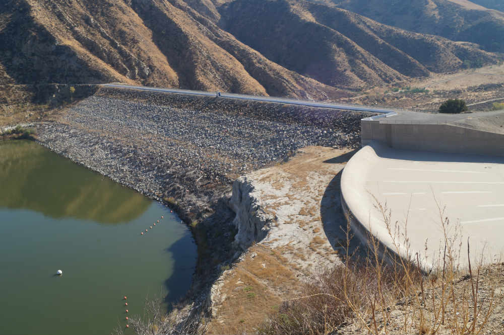
On the way, we noticed the cascades where Owens Valley River water comes into LA was shut off. It usually looks like this, just to the right of the northbound 405:

Not sure what it  meant meant that there was no water running, but we continued our way north

The very name “Santa Clara” is confusing in California. In northern California, there’s the town of Santa Clara (St. Claire of Assisi…after all, California was colonized by Spanish Franciscans), which grew up around the Mission of Santa Clara, established in 1777. Santa Clara Valley is now better known as Silicon Valley, much of which is contained in Santa Clara County.

What does this have to do with Ventura? Well, although there are three creeks that drain through northern California’s Santa Clara Valley, none of them are named the Santa Clara River (if anybody’s interested, the three creeks are Tomas Aquinos (Thomas Aquinas), Saratoga Creek, and Calabazas (gourds or pumpkins, depending on context) Creek. There is a Santa Clara River, but that’s in Ventura County. (FWIW, the Santa Clara River was named first, in August of 1769, because the Portola expedition discovered it a couple of days before Saint Claire’s date of death in 1253).

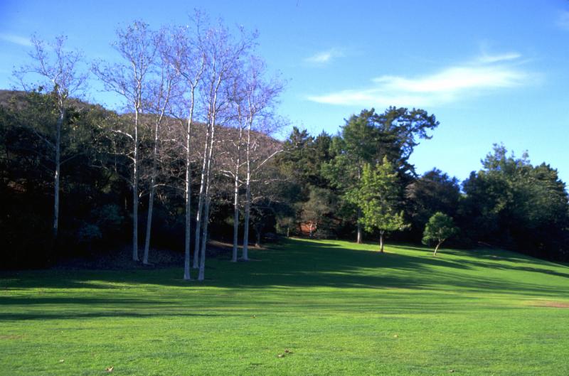
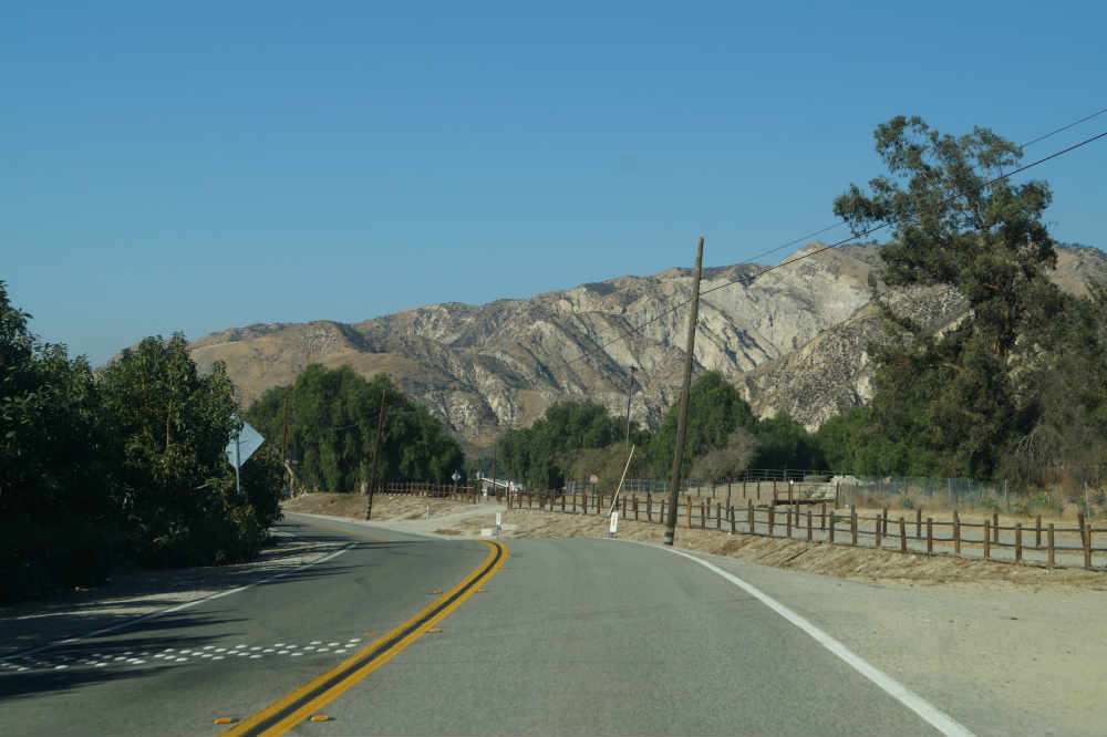
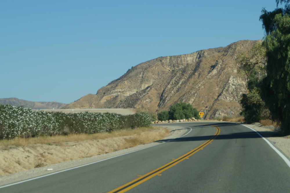
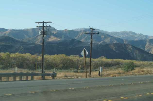
The Santa Clara River is one of the less restricted rivers in California, and is the only southern California river that hasn’t been dammed, either for irrigation or flood control. Because most of the river valley is used for agriculture, there are relatively few levees, either. The result is a lovely river valley that runs 83 miles from the San Gabriel Mountains that divide Los Angeles from the Mojave Desert, and is responsible for the rich soil that constitutes the Oxnard Plain. In Los Angeles County, the river has been largely overtaken by suburbanization, pretty much all the way out to the Mojave Desert cities of Palmdale and Lancaster. California State Highway 126 is just above the Magic Mountain exit:

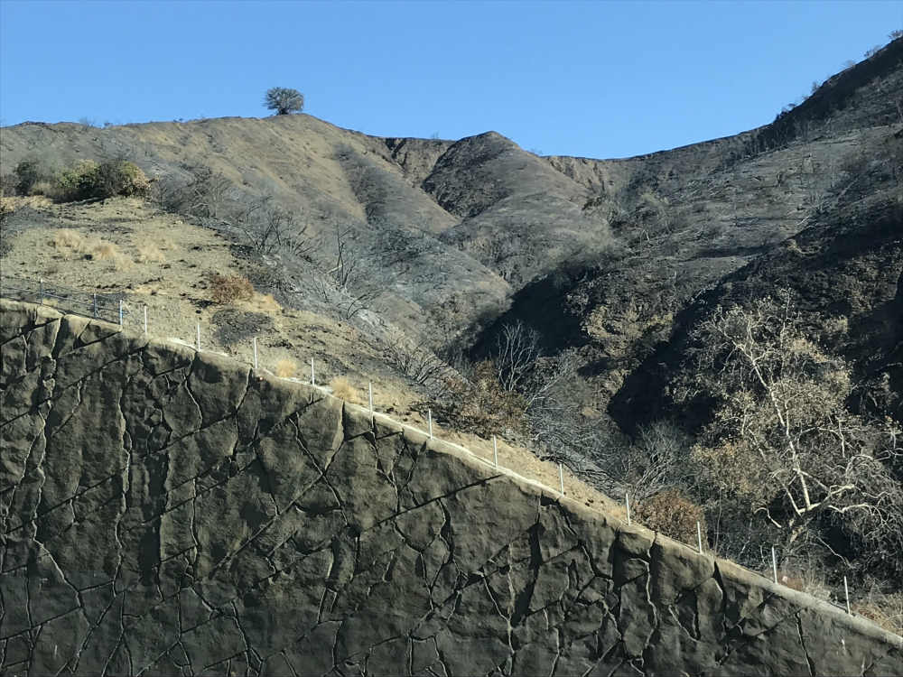
Magic Mountain is in the floodplain of the Santa Clara River. Most aerial pictures don’t show it clearly, but if you continue up the heights of Newall Ranch Road (the continuation of Route 126 on the LA/suburban side), you can get a view of the river and you realize, real fast, that Magic Mountain is built in the river’s floodplain. Probably will take a 100-year flood to wipe up it, but when you see it, there’s no question that a heavy rainy season will destroy the park. I haven’t found a good picture of Magic Mountain showing the topography, but perhaps you can get some idea from the following picture. The proclivity of southern Californias to build tens of thousands of homes below dams has to be seen to be believed, and will be the subject of a future post.

The river becomes rural almost immediately as you turn west. I have no doubt that LA County will eventually permit development up to the county line. Ventura County seems to have been more sensible and preserved its agriculture by appropriate zoning. The Ventura side reminds me a lot of the way that Riverside looked in the late 1950’s and early 1960’s.


There’s lots of citrus and avocados:

The valley isn’t terribly wide, and the river is always present. On the ground, the river is overgrown with trees, and looks something like this:

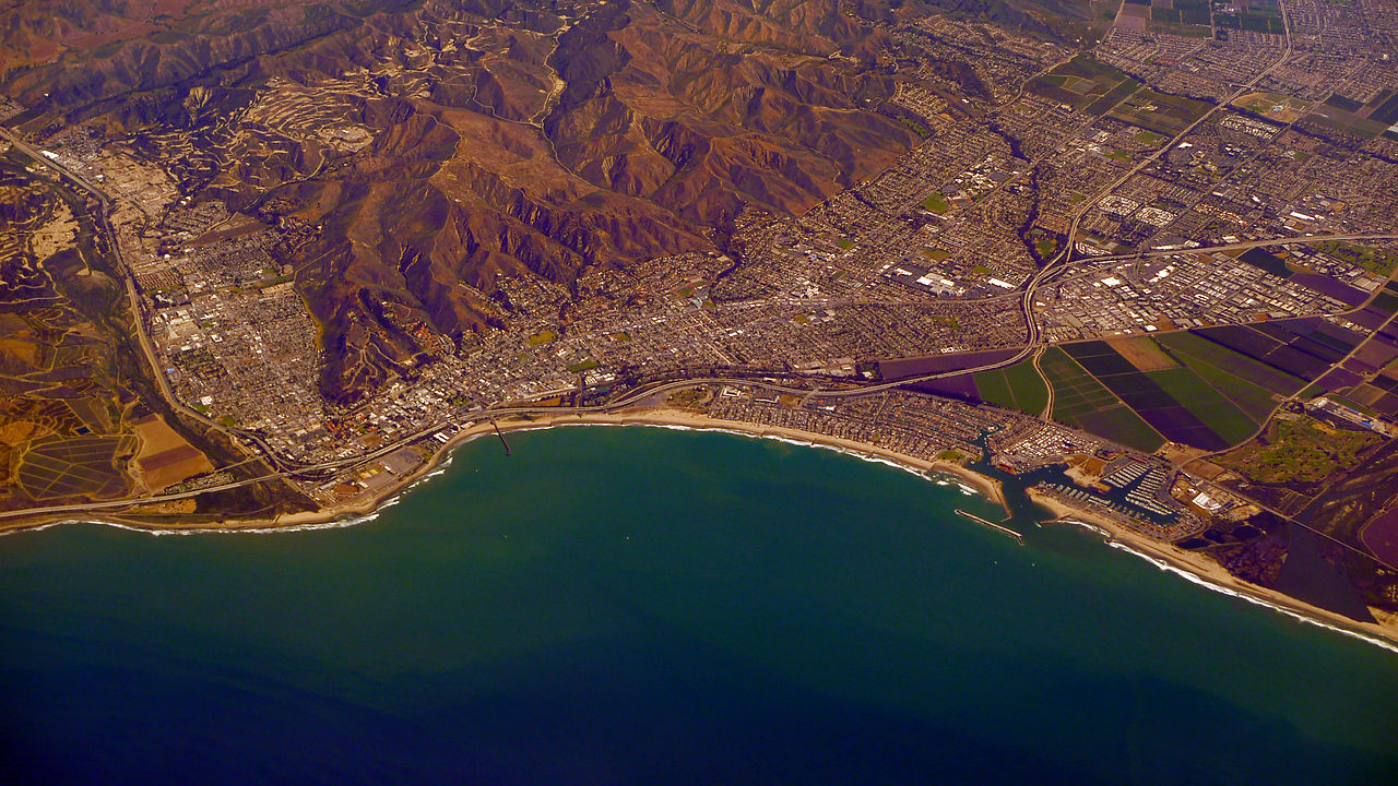
From the air, the width of the river is much more obvious. This aerial picture was taken at Piru, the community seen on the left of the photograph. Rancho Camulos, our first stop, was about 2 miles to the north.

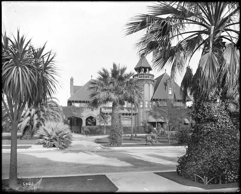
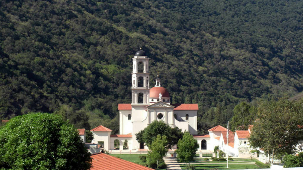
Rancho Camulos is an 1,800 remnant of a Mexican land grant of nearly 50,000 acres taken from the lands belonging to the San Fernando Mission. Conveniently, those lands went to the majordomo who oversaw the secularization of Mission properties. Funny how that works out, isn’t it? It was reported to be the rancho upon which Helen Hunt Jackson based her 1884 novel Ramona. In fact, the owner exploited the Ramona myth by selling their citrus under the Ramona label, which appears at the top of this post. Postcards from around 1900 also advertised the rancho as the home of Ramona and Alessandro:

Whether the prototype of Ramona actually lived on the Rancho Camulos is, in the long run, irrelevant and a typical example of southern California boosterism. The facts quickly (and permanently) are subsumed by the myth and the promotional activities designed to develop land sales or product purchases. Here’s what the same part of the rancho looked like when we visited it:

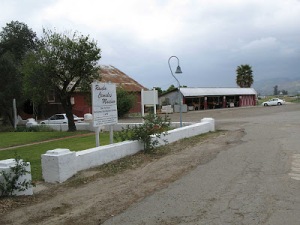
The rancho is a National Historic Landmark (supposedly the only one in Ventura County, but I haven’t been able to verify that) and has a fruit stand out front that we’d seen many times passing by. This time we stopped. The fruit stand was closed, as was the museum and park, but nothing was locked up, so we had pretty much full range of the place. The nuseum and grounds are officially open only on Sunday afternoons. For more information, see the museum website.

Thus far I don’t know a lot about its history. The rancho apparently shrank from 48,000 to its current 1,800 after the droughts of the 1860’s and 1870’s wiped out most of southern California’s famous cattle herds, something I want to research more, as it sounds like an instructive historical lesson. The del Valle family, which managed the ranch from the time their paterfamilias obtained in the grant in the 1840’s until they sold the ranch in 1923, quickly diversified into grapes, figs, citrus, and even made wine and brandy on the site. One of the buildings is the old winery and brandy distillery:

Many of the rancho’s buildings were seriously damaged in the 1994 Northridge earthquake, which is why the winery is surrounded by a cyclone fence and propped up.

The grounds occupy about 40 acres. The historiography problem is that it’s a mishmash of different periods and styles. Unlike earlier adobes, the advent of the railroads and the development of the Pacific Coast lumber industry meant that lumber that was grown in northern California was generally available for construction by the time the adobe was built in the 1850’s instead of having to rely on the sparse local lumber. The houses therefore look a lot more modern, and it’s hard to determine when the different buildings were constructed.

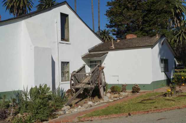
For example, the main house has three separate wings, shown on the map at the left. They don’t surround a courtyard, as would have been common during earlier adobe constructions. They’ve also been modified with such anachronisms as screening against insects, something surely unknown to the early Californios. As a result, the main house looks more like a modern-ish California ranch0-style house than an early Spanish adobe. The center no longer has a fountain or formal plantings, but rather a lawn and trees. The ranch house has three wings.  Here’s the north:

Here’s the middle wing (note the screening):

And here’s the south, all complete with screening as well.

The other side of the south end is the basis for the postcard and orange labels of Rancho Camulo. Here’s a picture on the east end of the south end. Not exactly historical, but it’s always interesting to see the kind of carts that were used in the 18th and 19th centuries:

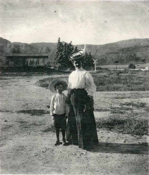
The ranch apparently was popular enough that the Southern Pacific Railway had a stop at Camulos where people could be fruits and nuts. THe station house still exists, although we didn’t realize it at the time, so we didn’t see it. Not much of a building ever, to judge from one of the rare historical photographs we have of the SP stop:

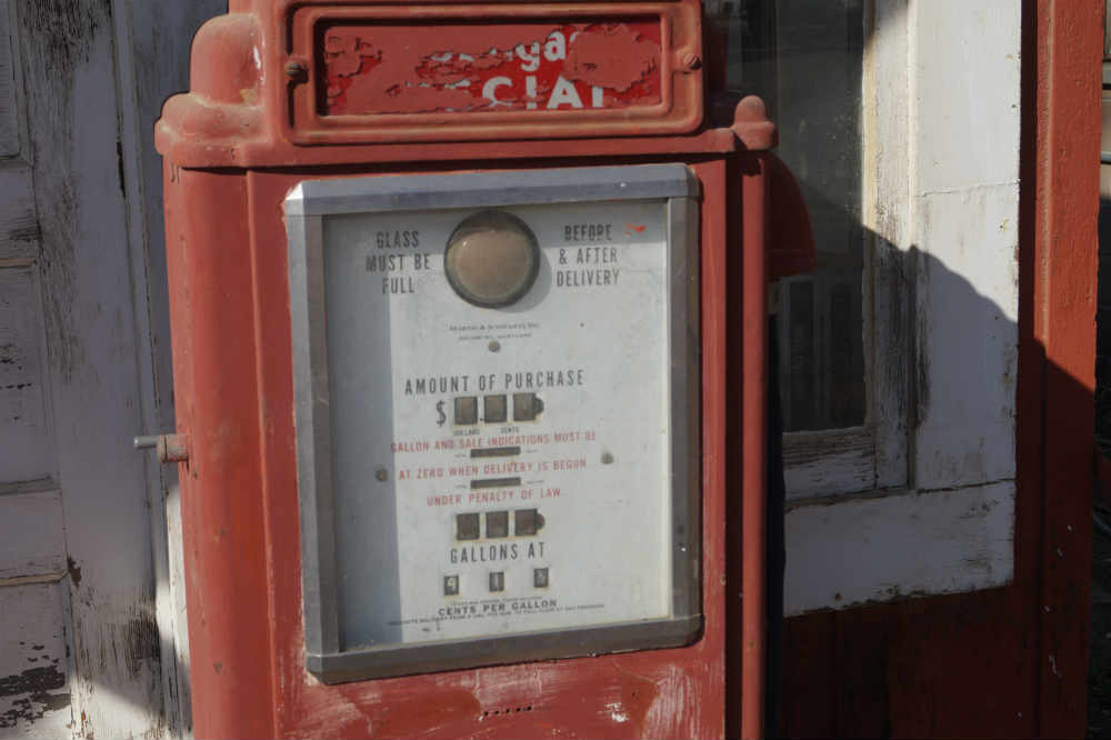
There are other oddities around the grounds that I haven’t entirely sorted out. Lots of weddings are held on the grounds but the chapel wasn’t built until the Rudel family bought the place in the 1920’s. It does have what looks like an old gas station….

….though whether gas was ever sold there isn’t clear, at least from walking around. The gas pump is a really old one, however:

We will be going back in March to hear a talk on the St. Francis flood from 1928 that I wrote about last year. We hope to tour the museum and get a better handle on the history and development of the buildings than we could get from just walking around. I’m also hopeful we can see what’s north of Route 126 around the Southern Pacific station house.  If you’re in the area on a Sunday afternoon, it’s definitely worth a visit.

En route to Ventura: the Skirball fire residue

We started out for Ventura on Tuesday morning, December 19, 2017. We live in West Los Angeles, and the Skirball Fire in the Santa Monica Mountains was a couple of miles away from where we live. In fact, I saw the fire start on, I think, Wednesday morning, December 6. On the Rapid 12 Santa Monica Bus bound for downtown at 5:45 am, we saw fires racing up the west side of the 405 toward the Getty Center and an even bigger blaze to the east of the 405 burning rapidly up the hillside on the east. All the riders of the bus (we all know each other; one of the odd things about LA is that it truly is just a bunch of villages joined together, whether the village is where you live or is made up of the people you ride the bus with at a pre-determined time of day) knew that we had Santa Ana winds that morning and none of us were surprised to see a major fire in our area.

The fire we saw that morning was burning below the Getty Center on the west side of the 405 (San Diego) freeway. That fire was small compared to a major blaze to the east of the 405. It was the one to the east that became the Skirball fire; apparently firefighters were able to extinguish the

The footage of the fires is dramatic. The intro picture was one taken the first evening of the fire. Needless to say–my motto is that it’s better to be a live coward than a dead her0–we didn’t come within miles of the fire, though we sure inhaled some of the smoke and ashes.

When we left for Ventura, we had to go north on the 405, whether we were going the direct way (Highway 101) or our preferred way, via State Route 126 through the Santa Clara River valley. We soon got to see the aftermath of the Skirball fire that I witnessed starting a couple of weeks before.

At places it had burned all the way down to the roadway:

The purple-ish/pink area on the map below shows the boundaries of the Skirball firewhich wasentirely confined to the east side of the 405:

I guess the firefighters were able to suppress it quickly, even though it broke out sometime after 5 am. I know because two fire engines raced up Bundy Drive while I was waiting for my bus. From the northbound 405, there’s no evidence of any fire damage.

Compare that with the hills on the east side directly across from where I took the above photo:

This is an area I used to hike quite a bit. It’s across from the entrance to the Getty Center. The trail was removed when they did bigger and fancier retaining walls along the 405, and they wiped up the park and parking area for a staging area. Looks like the oak on top of the hill survived, however.

Chaparral burns quickly and extremely hot. Compare the following hillside to what you saw to the west of the 405. This side looked the same, pretty much like any other chaparral; now it’s burned down to the ground.

This type of burning is why southern Californians always worry about rain following fires. Not only is there little protection, but the fire will often burn so hot that it effectively seals off the soil and doesn’t permit even the slightest penetration by rains. If you get a large storm dumping a lot of water at once, the fire-burned slopes will erode really fast as the water runs off in great quantities.

Not sure that we have much to worry about. The average, as of Christmas Day, 2017, of rain in Los Angeles is about three-and-one-third inches (3.34, IIRC). The season thus far:  0.12 inches. This is the driest December I can remember. There’s been no significant rain since February, and no sign of it this winter. The reasons I’ll discuss later, but it’s basically that the so-called Ridiculously Resilient High Pressure Ridge has parked itself off the California coast and is diverting all Pacific storms to the north, some going as far as Alaska before they can get around the ridge and resume their west-to-east slope. We, of course, don’t get the benefit of any of the moisture the storms bring. So we may have a much longer fire season than usual.